At the end of October, we flew into Barcelona, drove 3 hours to Andorra, and did the Coma Pedrosa hike which is Andorra’s highest peak and mountain.
Hiking Coma Pedrosa isn’t easy but it is definitely doable with a good level of fitness, determination, and a whole day to spend hiking in Andorra.
Andorra is a tiny country between France and Spain but Andorra is known for its skiing and hiking and when it comes to climbing the highest peaks in Europe, it’s a great one to do because it’s a big challenge due to its height of 2943m,
But you don’t need a guide to climb Comapedrosa as the trail is really easy to follow, you only need 1 day and there is no major danger in it like a glacier etc.
In this post, I’m going to give you details for hiking Andorra’s highest mountain and climbing Coma Pedrosa including where to park and start the hike, how long it took us, the terrain to look out for, recommendations on what to wear, and bring and where to stay in Andorra.
Coma Pedrosa Andorra

Find What You're Looking For Easily Here!
Quick Info for Climbing Coma Pedrosa:
Difficulty Level: Hard
Average Time Needed: 10 – 12 hours
Length: 13.7 km according to AllTrails
Suitable for Children: No
Parking Location: Aparcament del Parc Natural Comunal de les Vallas del Comapedrosa
Accessible by Public Transport: Public Buses do go past the parking spot but it might be best to get a taxi from Arinsal
To watch our Comapedrosa hike, have a watch of my YouTube video here:
Important Info for Climbing Coma Pedrosa:
Visit Andorra’s Website states it takes about 8 hours to do this hike. It took us 6 hours up and 5 hours down with 30 minutes at the top totaling 11.5 hours, far from 8 hours!
We did stop quite a bit and I’m confident if I did it in a smaller group I could have done it in 10 – 10.5 hours but from my experience, only ultra-fit and fast hikers can do it in 8 hours, so definitely give yourself 10 – 12 hours to be on the safe side.
This is a really tough hike and should be taken seriously.
It’s not particularly dangerous at any stage, however scrambling and climbing are required for the last third to get to the top and if you do the hike during winter there will be snow at the top making it more dangerous.
There is no phone signal for the majority of the hike and if you live in the EU with EU data roaming, Andorra isn’t part of the EU so you won’t have data access unless you pay more or get a local sim so if you’re doing the hike alone make sure you tell your accommodation what you’re doing.
Google Maps is rubbish to follow for this hike because there are no footpaths on it. I used maps.me and I downloaded the Andorra map so I could use it and follow it offline and it had all of the footpath on it really clearly!
You can watch my YouTube video here and my Instagram Stories here!
Where To Start The Comapedrosa Hike
We started the Coma Pedrosa hike here: Aparcament del Parc Natural Comunal de les Vallas del Comapedrosa.
Just before the apartment there is a car park which is free to park in.
What To Pack and Wear For Climbing Coma Pedrosa
As you can hopefully tell this is a serious hike so appropriate hiking wear is needed.
Hiking boots are a definite due to the terrain and length, you will struggle in trainers.
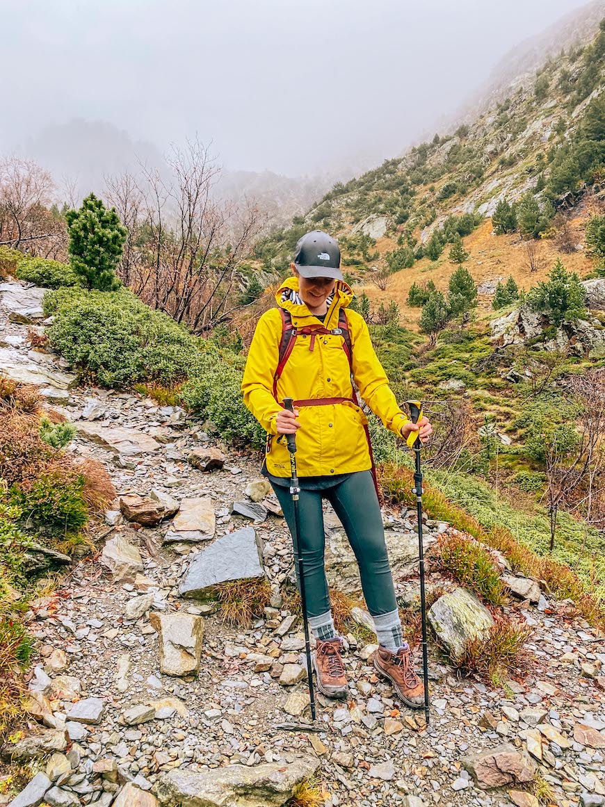
Layers are also key as the forest was warm and humid when we started, even at the end of October, but as we got higher it got much colder.
Trekking Poles were a huge help to us all and we all used them for the majority of the way. I have these folding trekking poles so they fit in my hand luggage case on the flight from home.
A Head Torch is a must because this is a long hike and depending on the time of year you might come down after sunset as we did and a phone torch was definitely not enough or safe enough. I use this
Where To Stay For Hiking Coma Pedrosa
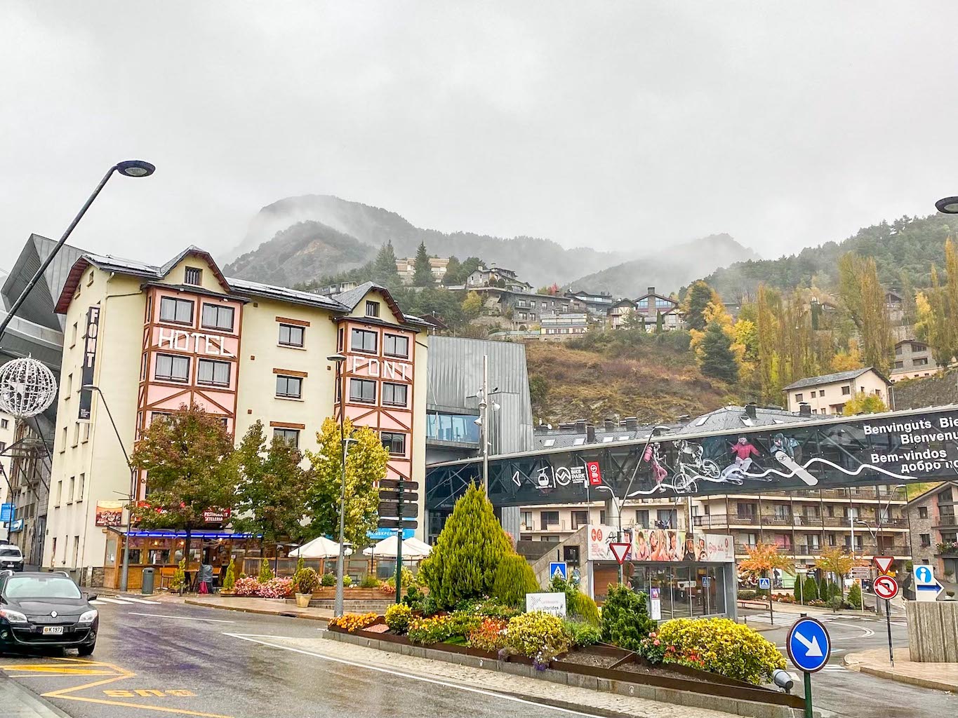
The closest village to the start of the hike up Comapedrosa is Arinsal so staying here is a good idea. It is a small area with a few hotels and places to eat. The start of the hike is just past Arinsal once you have passed under the tunnel.
Search for hotels and hostels in Arinsal here!
We stayed just down the road in La Massana at Font Andorra Hostel. They have a range of dorm rooms and private rooms with a sociable atmosphere and a great base for the hike so I really recommend staying here.
Andorra is only small so you could stay in the capital city of Andorra La Vella and drive up to Arinsal or get a taxi but I recommend staying as close as possible because believe me, after the hike you will want to lie down as soon as possible!
Search for hotels and hostels in Andorra La Vella here!
Hiking Andorra’s Highest Peak
Coma Pedrosa Route
Let’s get into the hike!
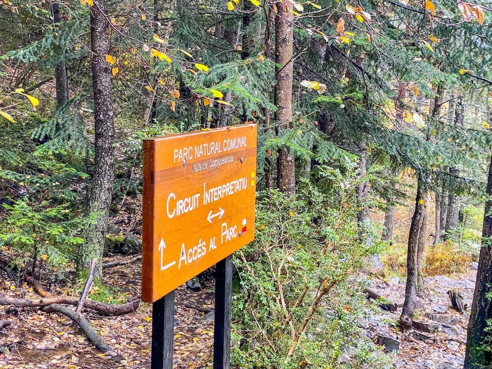
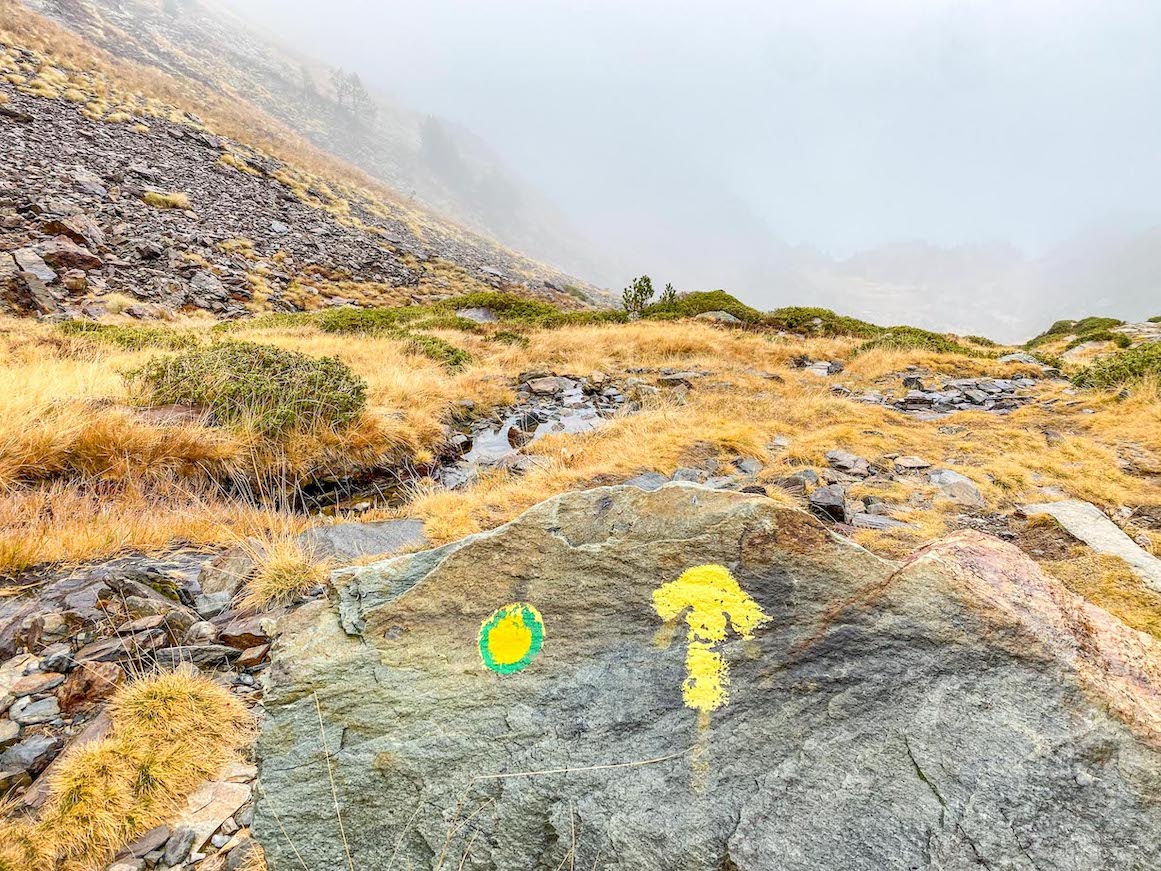
Firstly, the hike is well marked by signposts at the start of the hike and later by yellow paint marks on the rocks,
However because the start of the hike is through a forest which is the Comapedrosa National Park and it seems to be used for many leisure walks, there are a few footpaths so here you will need to keep checking the map on your phone and look out for signs.
Google Maps is rubbish to follow for this hike because there are no footpaths on it. I used maps.me and I downloaded the Andorra map so I could use it and follow it offline and it had all of the footpath on it really clearly!
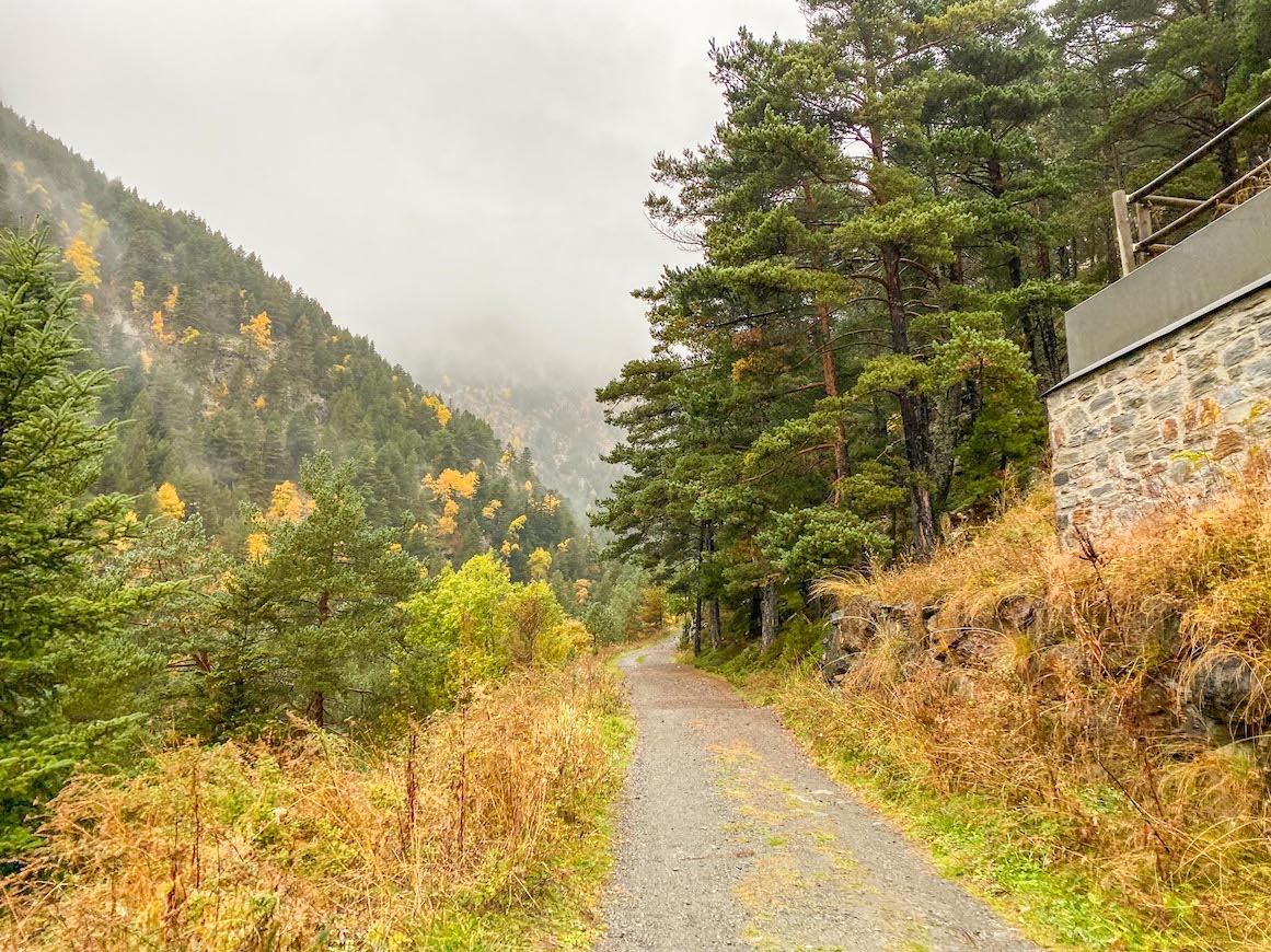
There are a few bridges that you’ll need to cross as you can see in my YouTube video, and the path gradually inclines through the forest.
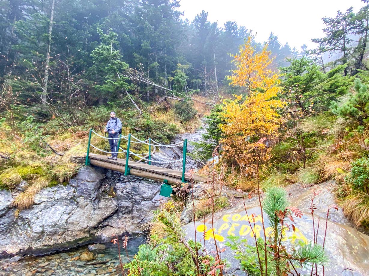
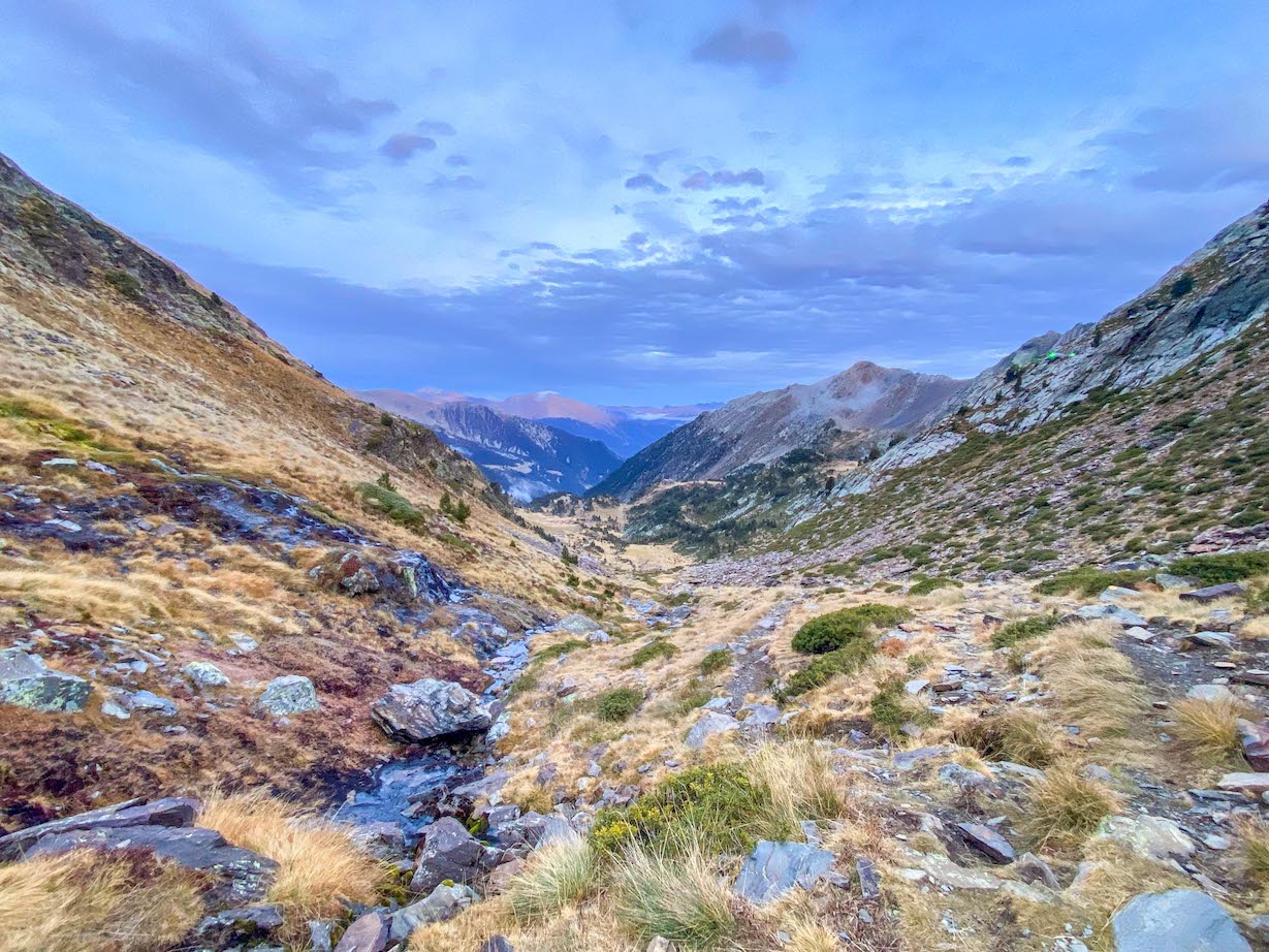
It took us about 1 hour walking through the dense forest and another 2 hours walking up through the valley where we had some forestry either side and where we followed the stream.
This is when the incline of the hike felt like it really started and my hiking poles came out.
After nearly 3 hours of walking the land opened up and we had a choice of 2 footpaths to take which I could see on my map then joined back to being the same footpath.
One of the footpaths to the right takes you via the Comapedrosa Refuge Lodge and along side 2 of the lakes on the hike, we didn’t take this footpath as the lodge was closed at the end of October and the path looked as it if inclined more.
So we took the footpath to the left which took is fairly straight through a fairly flat field, and we were pleased with this decision.
We stopped for lunch (some bread, cheese and fruit which we got from a supermarket before leaving the town we stayed in) and just afterwards the 2 footpaths join back into 1.
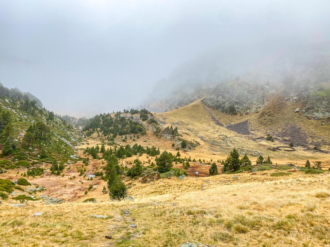
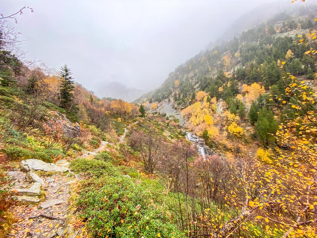
From here it’s a long inclined walk up through the valley along the rocky footpath.
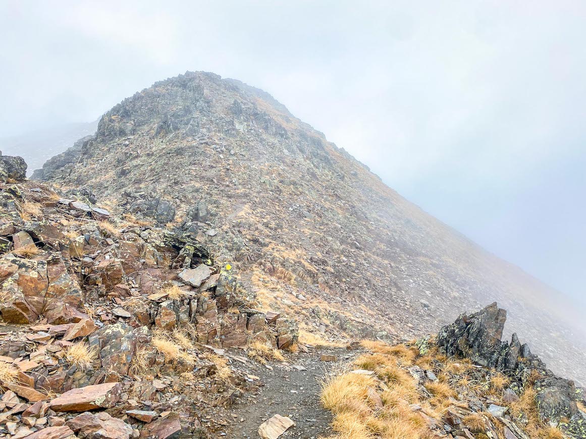
The footpath is noted clearly by yellow paint on the rocks and it zig zags quite a lot making it seem much tougher than it initially seems.
During this walk, Comapedrosa Summit is actually to your right and not that far away however the nature of this hike is that you have to go all the way round to get to the top which is why it’s also longer in length than you might expect when you first look at a map of the summit.
We turned the corner of the footpath to the right and started the next long uphill slog to the top.
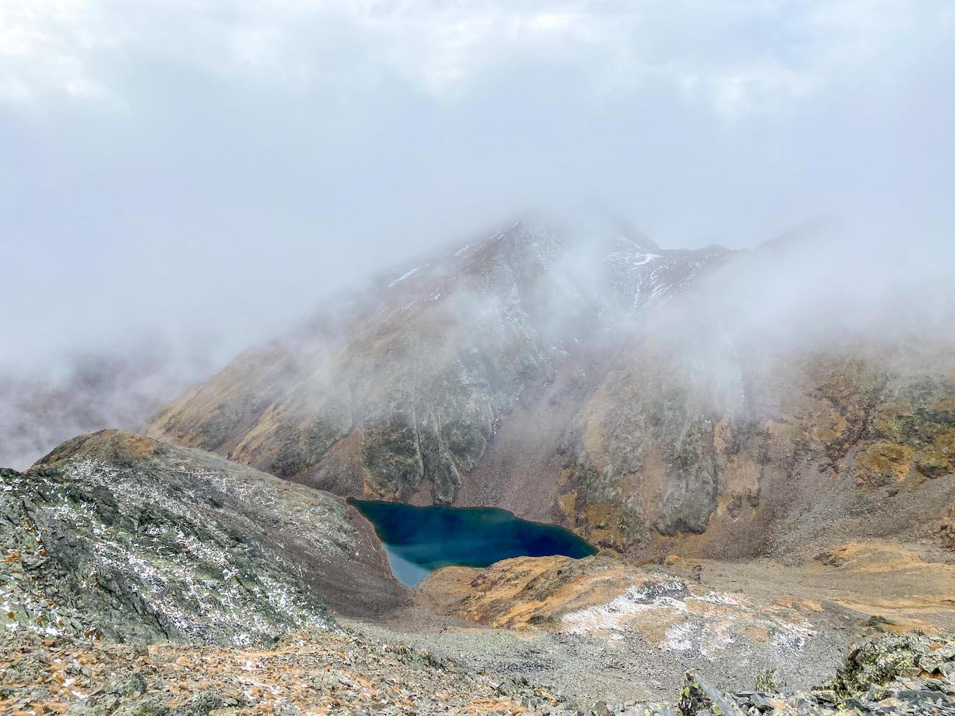
This path is broken up by 2 lakes, the first Lake Comapedrosa which you walk right past on the hike and then Lake Negre further up, the base of this Lake be accessed from the hike through a bit of detour down the track.
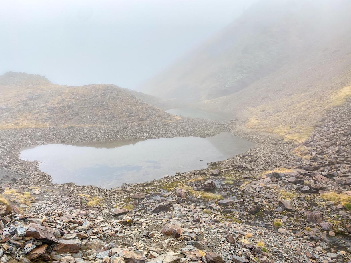
Once past Lake Comapedrosa we put our trekking poles away and put our gloves on as we started to use our hands to get us up the rocks.
The path here became less obvious as it’s crossing the ridge, however there are still yellow markers and as long as you look for them and follow them, you will go in the right way.
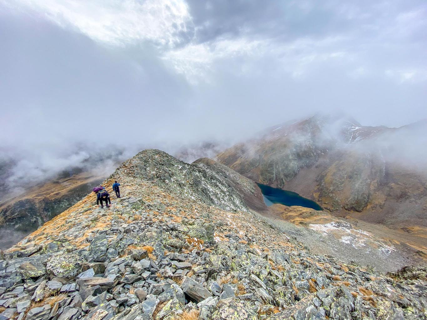
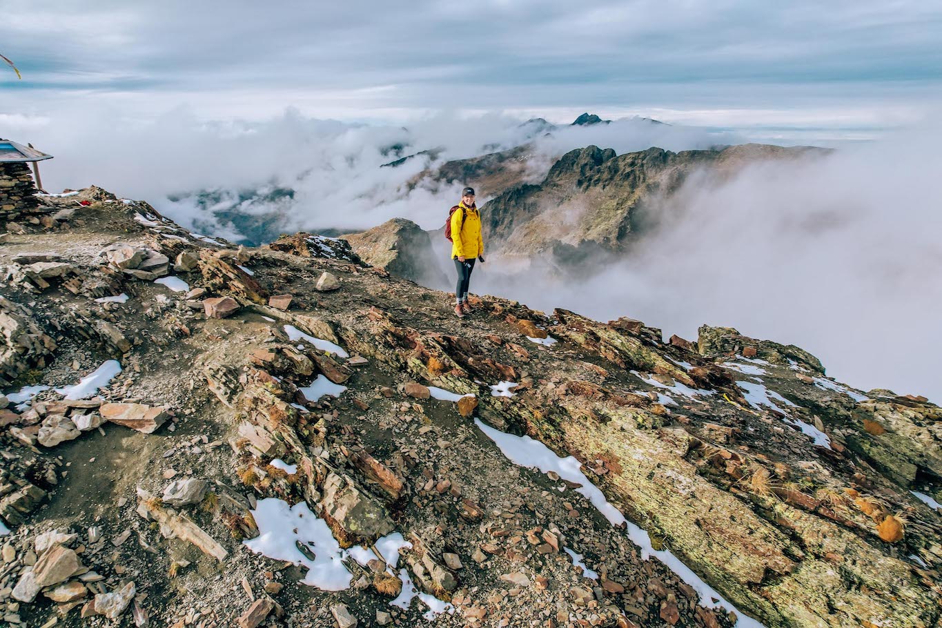
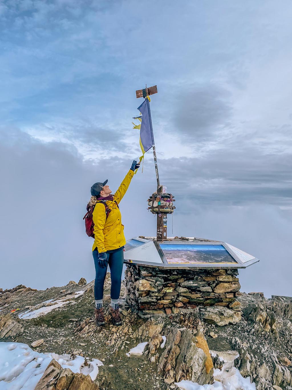
When we did the hike up Andorra’s highest mountain it was very cloudy as you can see in the photos so we couldn’t see the summit through the cloud, however on the way down it cleared a lot and as we were around Lake Negre looking back we could see the summit and flag in the distance so look out for this.
The final part up was most definitely a struggle, our legs were tired, we were lacking in energy and it was just tough but we pushed through it, especially when we could start to see the summit just above us!
When we reached the summit we had started the hike 6 hours ago! As mentioned, I think if I had done the hike with less people I could have done it in 5 hours – 5.5 hours but giving yourself 6 hours is a good idea as we were all averagely fit and didn’t go ridiculously slow.
The summit is pretty open so there’s plenty of places to sit and enjoy the views.
We went back down the same way which took us 5.5 hours.
However we did the last 3 hours in the dark so we did walk a bit slower and more cautiously because of this, had we done it in summer with more light it might have taken us a bit less time.
I have seen videos of people stopping to go wild swimming in the Lakes so if you do the Coma Pedrosa hike in summer, you might want to give time for this too.
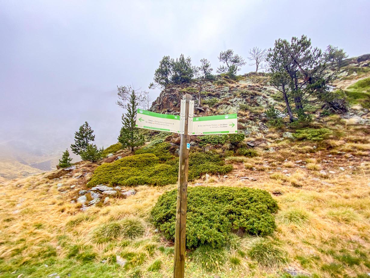
From the summit, there is the option to go to another peak called Pic de Balau which is right on the border of Andorra and Spain and really close to the French border too. There is a signpost at the summit to follow this footpath.
I hope this helps you plan your Coma Pedrosa hike and hike up Andorra’s Highest Mountain!
You can watch my YouTube video here and my Instagram Stories here!
For more of my posts see:
Shervin barforosh
Monday 2nd of October 2023
Hey man! Thanks for the article!
Im thinking of doing this hike in the end of october this year. I was wondering about the trekking conditions. Was there any snow this time of the year?
Cheers, Shervin
TheWanderingQuinn
Monday 16th of October 2023
Hello, we did it at the end of October too and there was a bit of snow at the top but not too much on the paths and we didn't need to put our crampons on for it. Good luck!
Manon
Sunday 29th of January 2023
Hi! Do you think it is possible to complete this hike with a dog?
TheWanderingQuinn
Monday 30th of January 2023
Hello, if they are used to doing this kind of distance and length of time then I'd say so. There's nothing technical that would stop a dog, just the height and length of the hike.